

Altitude Checker app for iPhone and iPad
Developer: Takafumi AMANO
First release : 23 Apr 2013
App size: 283.56 Mb
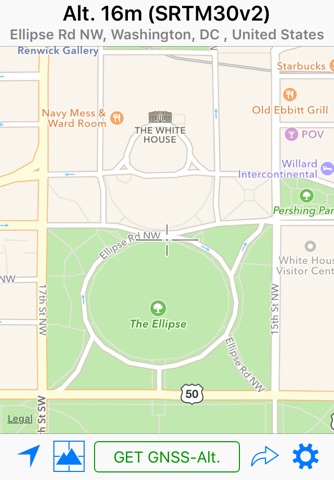
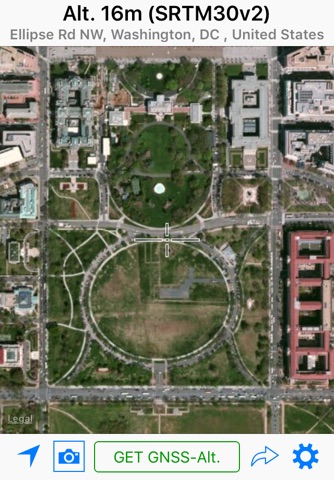
This app is a tool that measures an altitude of a current position or arbitrary points. The app has two measurement modes. One is a map measurement mode and the other is a GNSS mode.
■ Map Measurement Mode
If the app is executed, it will become this mode. In the mode, an altitude of a center position of a map is measured using a digital elevation model (DEM).
The app uses SRTM30 V2 to measure the altitude. A GSIs API can be used if you turn ON a “Use GSIs API” switch on a settings screen. The API can compute Fundamental Geospatial Data (FGD) in Japan.
■ GNSS Mode
Tap on the “Get GNSS Altitude” button will start the GNSS mode. In this mode, the altitude is calculated by GNSS. If you are using iPhone 3GS or earlier, a return value is an ellipsoidal height.
■ Settings
Unit - Meter and Foot.
Special Datum - Default (MSL), A. P. (Arakawa), Y. P., O. P., K. P., S. P., A. P. (Yoshinogawa), T. P. W. and B. S. L.
Coordinate System - You can use “Japan Plane Rectangular Coordinate System” instead of Latitude-Longitude.
Display Address - It displays the address of the current location. If this switch is off, it displays coordinates instead of the address.
Use GSIs API - the above‐mentioned.
Use GSI Tiles - Use GSI tiles instead of Apple Maps.
Update to Map Coordinates - It automatically updates coordinates in the “Move Anywhere” page to a current position on the maps.
Use Light Mode for Maps - The maps are displayed in Light Mode even when using Dark Mode.
■ About URL Scheme
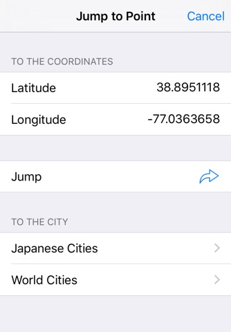
(Format) alt://lat/long
lat: Latitude (double value)
long: Longitude (double value)
If the latitude is not in the range of ±90 degrees will replace the latitude and the longitude.